
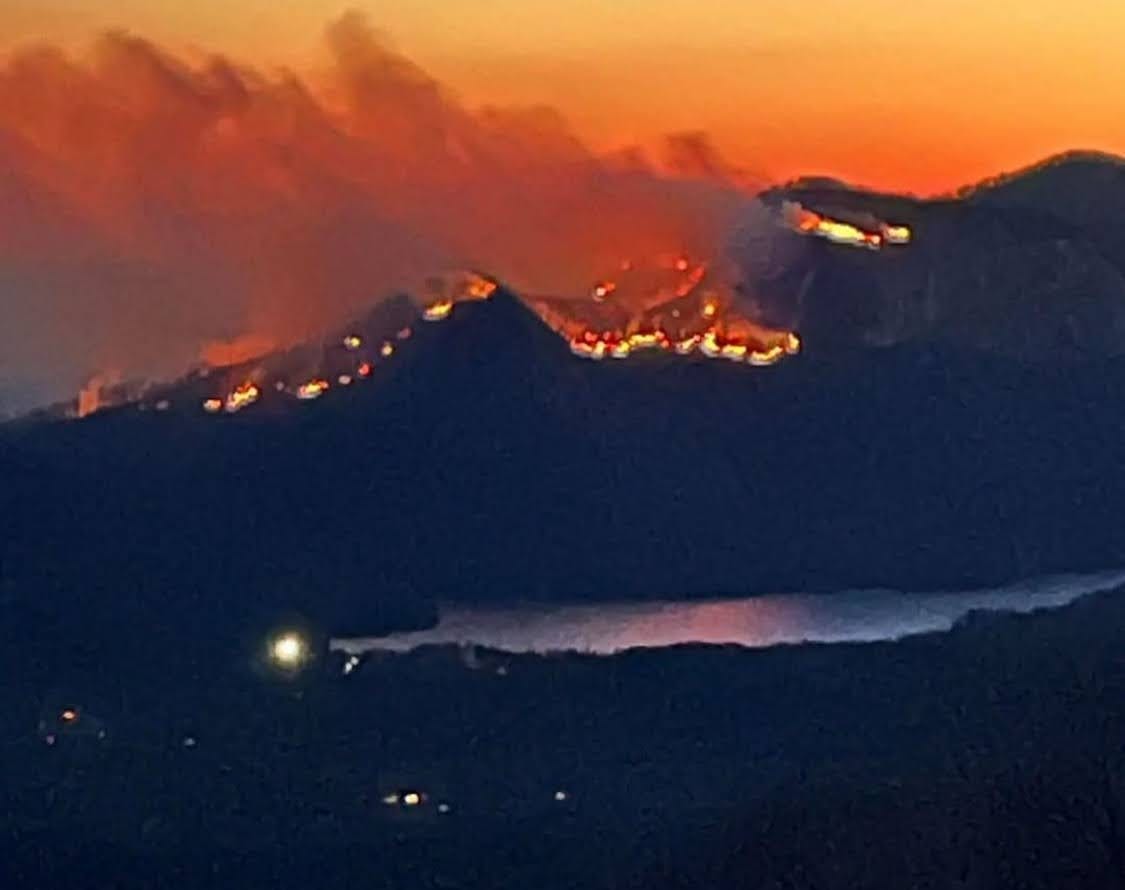
WILDFIRE CHEAT SHEET
I wanted to put a list of good resources together for my IN THE KNOW subscribers - so you can check on the info you need at any time.

COUNTY INFO PAGES
(usually have some of the best consistent info on evacuations etc)
Pickens County Facebook
Greenville County Facebook
Polk County Instagram
Transylvania County Facebook
Henderson County Facebook
Rutherford County Facebook
SC EVACUATION LINE
Confused about whether you need to evacuate? If you are in the line of the Table Rock or Persimmon Ridge fire call this number.

TABLE ROCK COMPLEX MAP
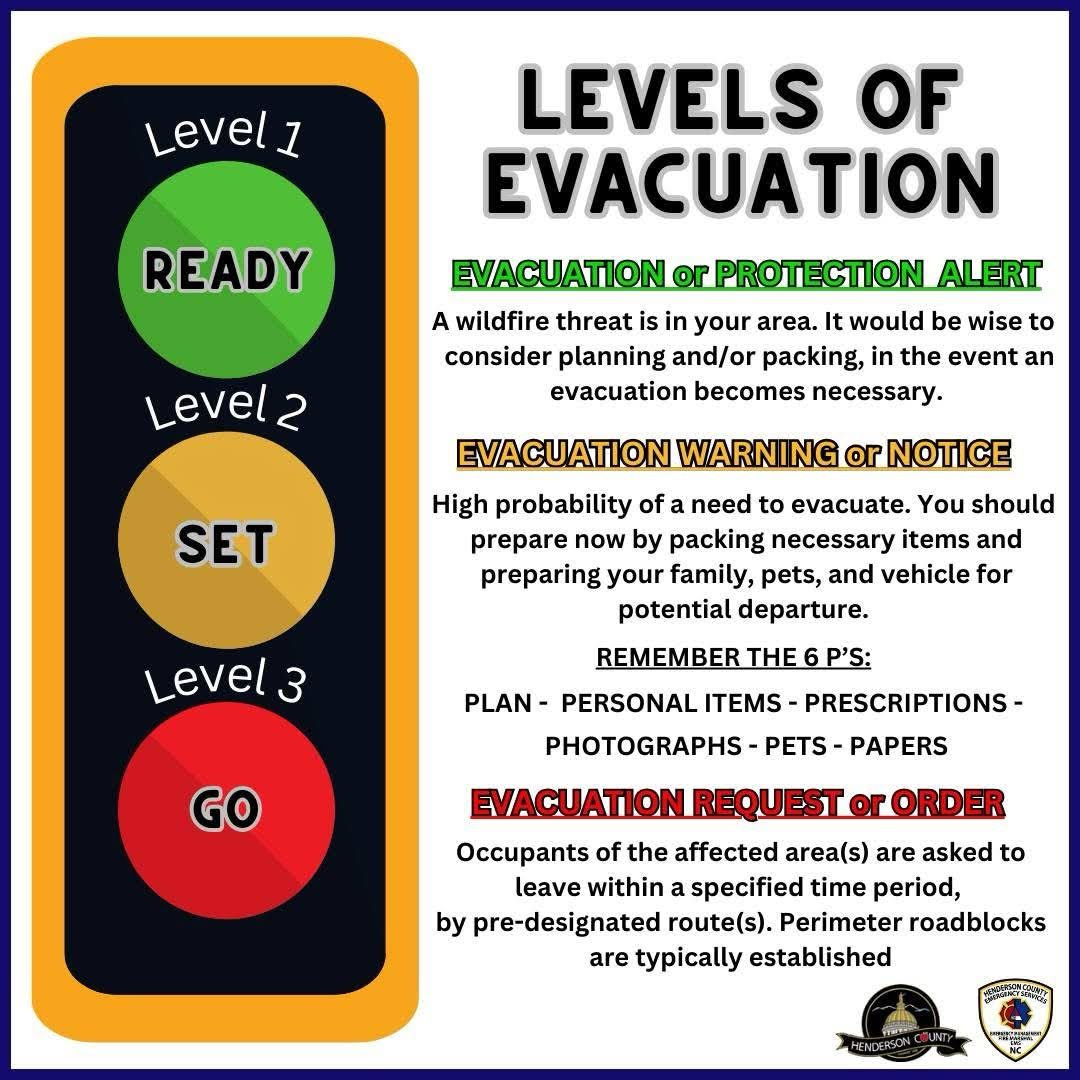
NORTH CAROLINA EVACUATIONS NOW HAVE A SPECIAL MAP
TRAFFIC LIGHT SYSTEM puts you on standby, then get ready and then alerts you to go, based on the red, yellow and green colors. EVAC MAP HERE
FORESTRY PAGES
NC FORESTRY Facebook
SC FORESTRY Facebook
LIVE VIEWS
Live camera pointed at Table Rock State Park
MAPS
NC EVACUATION MAP
SC FORESTRY MAP
SMOKE FORECAST
This website below has great maps and detailed info for communities near you when you share your location with the page. You get current and forecasted outlooks for smoke so you can plan.
https://outlooks.airfire.org/outlook/7832a30f
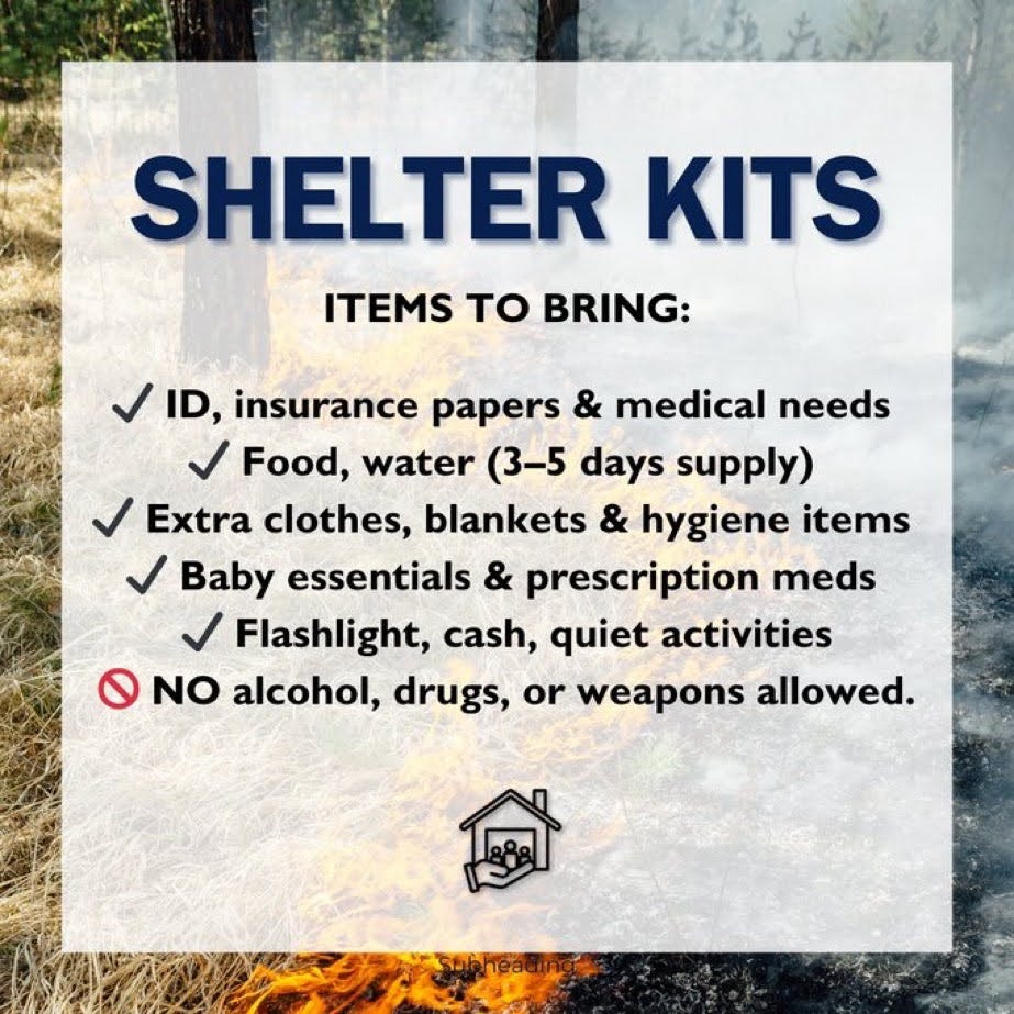
WHAT TO TAKE WHEN YOU EVACUATE
PROTECTING HOMES
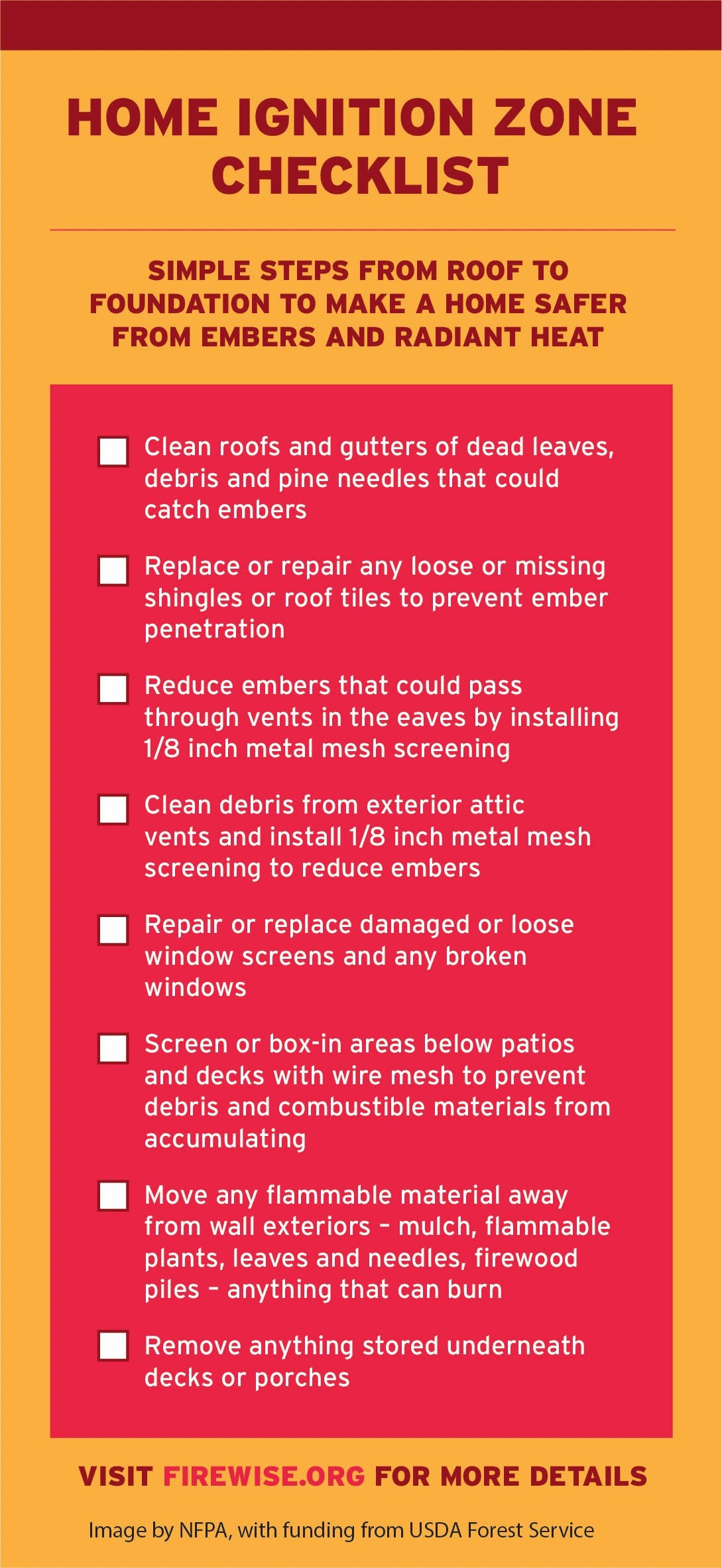
READ THIS ARTICLE to learn more about ways you can prepare for times like this.